Departement Haute Vienne 87 Pierre Branlante 2022 ©maxime Authier (7)Departement Haute Vienne 87 Pierre Branlante 2022 ©maxime Authier (7)
©Departement Haute Vienne 87 Pierre Branlante 2022 ©maxime Authier (7)
Walks with beautiful viewsNature is everywhere, offering you its most beautiful landscapes!

Our selection of walks with beautiful views

From high points to breathtaking landscapes, exceptional views of nature and other more discreet but equally beautiful views of the Limousin countryside, you’ll never tire of our panoramas! ✨🌿

The Mont Gargan

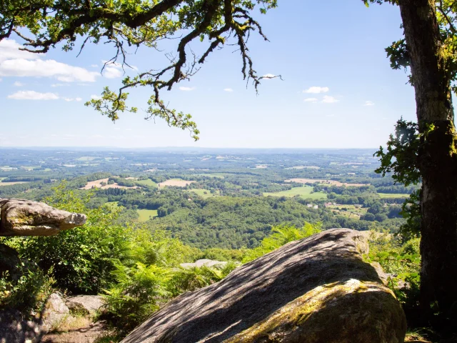
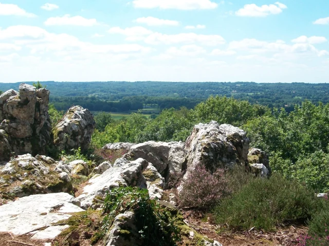
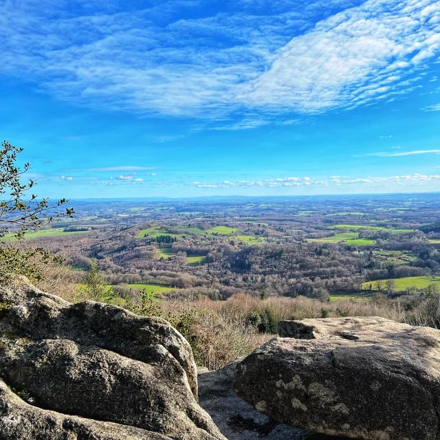
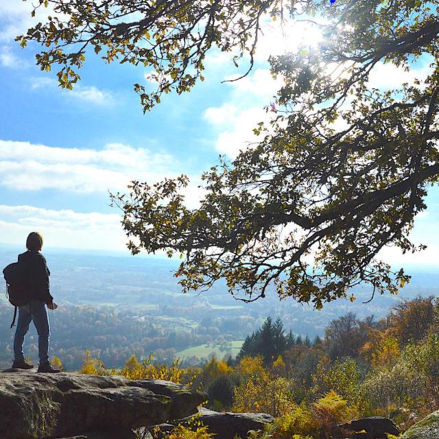
One of the highest points in Haute-Vienne

Rising to 731m, the Mont Gargan is a listed natural monument. It is also a site of landscape interest in the Parc Naturel Régional de Millevaches en Limousin.

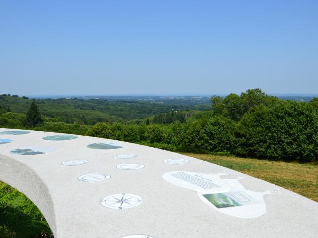
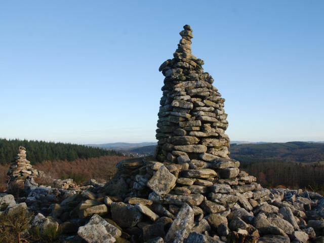
From the summit, you can enjoy a vast panorama. Two orientation tables make it easy to find your bearings and identify distant summits.

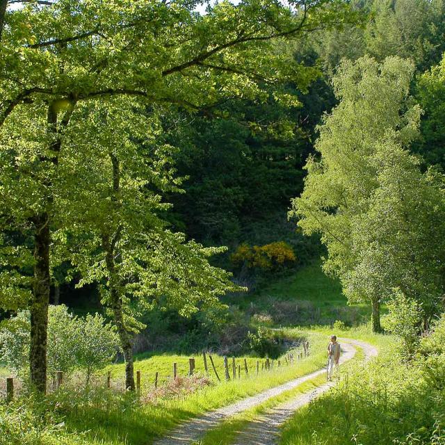
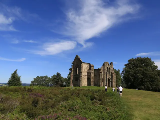
A 2.2 km trail takes you on a journey of discovery, starting at the beech tree alley. The remains of the Notre-Dame-de-Bon- Secours chapel, the devotional fountain, the memorial stone commemorating acts of the Resistance and the heather moorlands, a vestige of the local agropastoral landscape, are the highlights of the circuit.

The Montbrun trail

In the heart of the Parc Naturel Régional Périgord-Limousin

The Montbrun trail is located in the commune of Dournazac, capital of the chestnut which is the emblem of the Limousin.

It takes hikers to the highest point in the south-west of the Haute Vienne department: the Grand Puyconnieux, a landscape discovery site whose highest point is 498 m, with views of the Monts de Châlus and Monts de Blond. Its ecological, floristic and faunistic interest has led to its protection.

It has long been a popular destination, offering exceptional views over a vast area of the Haute-Vienne and Charente regions.

Admire the 15th-century Château de Montbrun, one of the finest castles on the Richard the Lionheart Route.

A 16 km walk of moderate difficulty.

La Balade de Victurnien

Between streams and forest

Saint-Victurnien owes its name to a hermit who, according to legend, lived in the forest on the banks of the Vienne in the 5th century.

Following in the footsteps of this hermit, discover numerous viewpoints and panoramas, through the sunken paths of our countryside. A pleasant walk along streams in the heart of the forest.

You’ll pass by the Croix des Châtaignols, a devotional site where the faithful used to hang up clothes that had come into contact with diseased parts of the body in order to obtain healing.

5.7 km trail.

Along the Briance river

Between heritage and nature

From the 10th-century chapel of Notre Dame de Chauveix, to the listed 16th-century Vieux Château, the village of Nouailhas with its manor house, the church of Vicq-sur-Breuilh and the château de Traslage, discover the Briance river, its rich heritage and its views over the countryside.

7 km trail.

La Pierre Branlante

One of the most beautiful panoramas in Haute-Vienne

Located in La Jonchère-Saint-Maurice, the Pierre Branlante is a gigantic rocky chaos perched at an altitude of 650 m, from which the view stretches as far as the eye can see for over 50 km. The village of La Jonchère can be seen 300 m below.

There are several ways to get there:

– From La Jonchère-Saint-Maurice, a commune with a rich architectural and natural heritage not to be missed, drive 4 km towards Saint-Léger-la-Montagne, then take the 1st left after Mallety. Walk for 450 m.

– From Sauvagnac (Saint-Léger-la-Montagne), walk 1.6 km: a beautiful village typical of the Limousin where you can discover the chapel and its stained-glass windows, and pass through the door of the Maison de la Tourbière.

– For good walkers, follow the Kaoliniers path for 9.3 km or the 5.6 km variant.

The choice is yours!

The Butte de Frochet

One of Haut Limousin's most emblematic sites

An 8.7 km hiking trail (with a 9.7 km variant) allows you to discover the site, as well as a 3 km interpretation trail to learn more about the flora and fauna present on site.

The Butte de Frochet is a unique landscape site, created by the largest quartz outcrop in the region. Part of the site consists of a vast chaos of boulders offering a view of the Charente River Limousine. The remainder follows a ridge line on which dry moorland has developed in various stages.

The Butte de Frochet has seen many human activities (grazing, mowing, quartz mining), which have given rise to numerous legends.

The Conservatoire Régional des Espaces Naturels du Limousin manages around 30 hectares of the site.

The Poets' Way

On the heights of Lake Vassivière

Located in the commune of Peyrat le Château, on the shores of Lake Vassivière, let’s discover the Chemin des Poètes. This 5km round trip walk takes you along the Bois de Crozat and its rare tree species.

As you walk, you’ll come across sculptures that invite you to decipher the poems engraved in the granite.

Once you’ve reached the orientation table, you’ll find the visual cues for this vast 360° panorama. Below, admire the Roches Brunagères, large slabs of rock with their sarcophagus-like cavities, which have come to be regarded as Druidic monuments.

There are also two tumuli, burial mounds dating from the 1st century AD: the Quenouille tumulus and the Puy la Besse tumulus. The latter, at an altitude of 775m, offers a magnificent view of the surrounding area.

The Tupes

In the footsteps of the Gallic Lemovices

Cross-country trails take you to the heart of the Limousin countryside. Sometimes a sunken lane, sometimes a viewpoint or a valley nestled between pastures.

Saint-Denis, caught between the valleys of the Maulde, Combade and Vienne rivers, is bordered by water. A discreet watermark, water is omnipresent and will be your common thread along this 12.9 km walk, fountains and watering holes, ponds and streams… Along the way, you’ll also admire meadows, the Bois du Coucou, a manor farm and more.

On this route, the landscape opens up: it’s easy to imagine that a few centuries ago, the largest oppidum in Gaul, that of the Lémovices (ethym. “Limousins”), was located here, at the confluence of the Vienne and Maulde rivers, a veritable economic and political capital in the 5th century BC. It was finally moved 5 centuries later to the present-day site of the city of Limoges (Augustoritum).

Close